Content
2003-2007 Sand Hills Biocomplexity: Integrating Biogeophysical Processes across Space and Time
Vitaly Zlotnik's research | Go back to his website
Funded by National Science Foundation
Today, the Sand Hills are stable and covered by native grassland interspersed with wetlands and lakes. The starting point for the Biocomplexity Project was the recent observation by UNL geoscientists (David Loope et al.) that many of these dunes lost their grass cover and were destabilized and active as recently as 900 years ago. Our multi-disciplinary team of fourteen UNL scientists studied grassland ecology, geology, meteorology, and groundwater to address reasons of stability of the modern ecosystem. My students and I explored groundwater recharge under various climate change scenarios. Using experimental data at the Grassland Destabilization Experiment Site at Barta Brothers and coupled land-surface-vegetation-root zone-vadose soil moisture model in the framework of HYDRUS1D (Jirka Simunek), we investigated the magnitude and factors affecting groundwater recharge in different soil conditions, spatial patterns of soil saturated hydraulic conductivity in dune environments, and trends in actual evapotranspiration. Tiejun Wang defended his dissertation in 2008.
Publications
Szilagyi, J., V.A. Zlotnik, J.B. Gates, J. Jozsa, 2011, Mapping mean annual groundwater recharge in the Nebraska Sand Hills, Hydrogeology Journal, 2011, v. 19: 1503-1513, DOI 10.1007/s10040-011-0769-3
Wang, T., V.A. Zlotnik, J. Simunek, M. Schaap, 2009, Using process-based models and pedotransfer functions for soil hydraulic characteristics to estimate groundwater recharge in semi-arid regions. Water Resour. Res., Vol. vol. 45, W04412, doi:10.1029/2008WR006903
Wang, T., D. Wedin, V.A. Zlotnik, 2009, Field evidence of a negative correlation between saturated hydraulic conductivity and soil carbon in a sandy Soil, Water Resour. Res., Vol. 45, W07503, doi:10.1029/2008WR006865
Wang, T.,V.A. Zlotnik, D. Wedin, K.D. Wally, 2007, Spatial trends in saturated hydraulic conductivity of vegetated dunes in the Nebraska Sand Hills: Effects of depth and topography, J. Hydrol., v. 349, 88-97, doi: 10.1016/j.jhydrol.2007.10.027
Measurements of Energy Budget and Surficial Vadose Zone Parameters
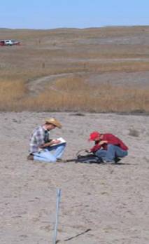
Preparing a borehole near water-budget for water budget assessment
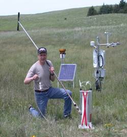
Tiejun Wang measuring hydraulic conductivity
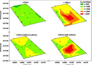
Contour maps of Kf at three depths for Plot 2.
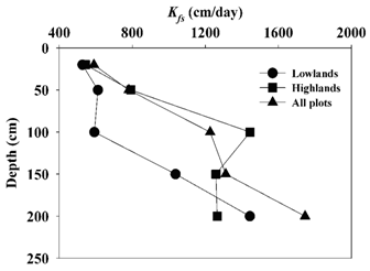
Vertical Profiles of Surficial Hydraulic Conductivity at Barta Brothers ranch (average Kf from all tested plots)
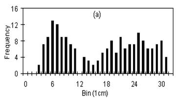
Annual Recharge Histogram, loamy sand soils, GDEX Recharge ranges from 0 to 20 cm (Computed with HPRCC data)
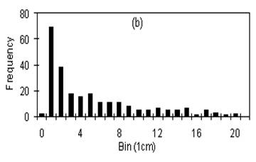
Annual Recharge Histogram, sand soils, GDEX Recharge ranges from 3 to 32 cm (Computed with HPRCC data)
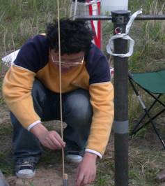
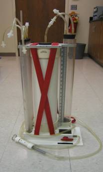
Constant Head Permeameter
Grass Destabilization Experiment (GDEX)